A Physical-Motivated Three-Dimensional Gaussian Process Based Ground Segmentation Algorithm with Local Characteristic Estimation
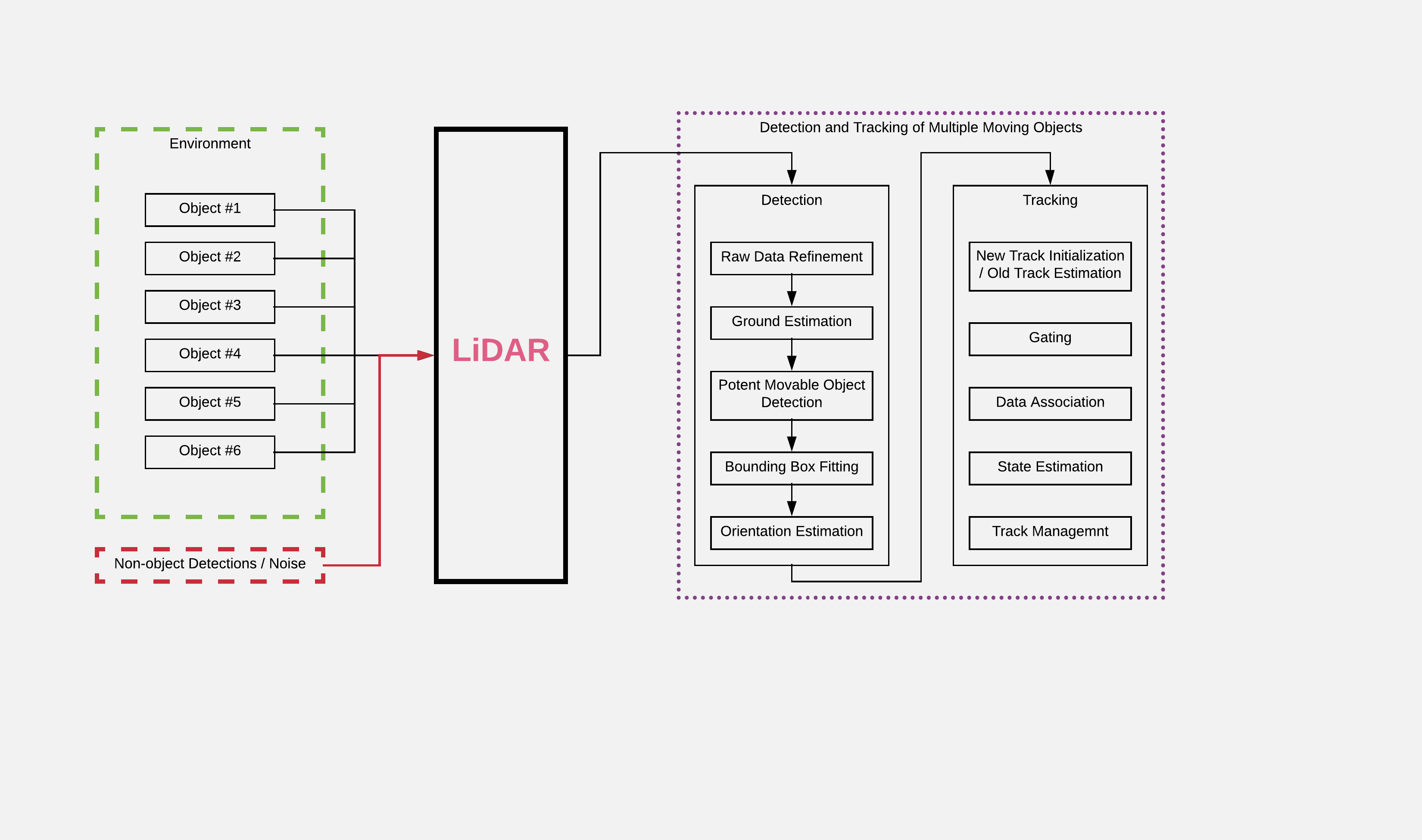
Autonomous Land Vehicles (ALV) shall efficiently recognize the ground in unknown environments. A Gaussian process based ground segmentation method is proposed in this paper, which is fully developed in a probabilistic framework due to implementation of Bayesian inference. The data is segmented using a radial grid map. Two joint Gaussian processes are introduced to separately model the observation and local characteristics of the data. While, observation process is used to model the ground, the latent process is put on length-scale values to estimate point values of length-scales at each input location. Input locations for this latent process are chosen in a physical motivated procedure to represent an intuition about ground condition. Furthermore, an intuitive guess of length-scale values is represented by assuming of the existence of hypothetical surfaces in the environment that every bunch of data points may be assumed to be resulted from measurements from this surfaces. Bayesian inference is implemented using maximum A posteriori criterion. The log-marginal likelihood function is assumed to be a multitask objective function, to represent a whole-frame unbiased view of the ground at each frame. Simulation results shows the effectiveness of the proposed method even in an uneven, rough scene which outperforms similar Gaussian process-based ground segmentation methods. While adjacent segments do not have similar ground structure in an uneven scene, the proposed method gives an eficient ground estimation based on a whole-frame viewpoint instead of just estimating segment-wise probable ground surfaces.